
Woodhull Students Walk Across Asia
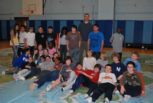
The hardwood floor in the Woodhull Intermediate School gym was recently covered by a huge National Geographic map of Asia for two days as teachers used a novel approach to deliver lessons about far away lands.
"The ultimate goal of the initiative was to have students visually and physically interact with a large scale, floor-based map of Asia, allowing them to not only see a specific location, but to walk it on a scale they typically do not see," said Joseph Leavy, district director of humanities. "The experience was intended to, and in fact did, allow these sixth graders to play while they learned and explored with friends."
 Woodhull teachers Conrad Dierking, Scott Armyn, Patricia Nowack and Janet Myers led the lessons. Physical education teachers Carrie Postel, Eric Triolo and Natalee Rubcewich worked side-by-side with the classroom teachers to capitalize on the numerous teachable moments with the entire class, smaller groups or even individual students.
The teachers and students interacted with the map in a variety of ways including:
• Students were given 'nation cards' that required each youngster to find a nation. Using the card and their own background knowledge, students later shared information about that nation with classmates.
• Some students read information from the cards after finding their nation, as teachers provided hints. Here is how one such teacher-student conversation went: Teacher: "You can find India if you walk south from where you are. By the way, where are you now?" Student: "Ah, Russia." Teacher: "OK, what nations are around you, and which way is south? Go to India now and take a plane, because walking will take you days!"
• Students were prompted to imagine they were riding the Trans-Siberian railroad from Moscow to Beijing.
• Following a brief discussion and explanation of the concept of sea level, students participated in a latitude and longitude game, searching for the highest (Mount Everest) and lowest (Dead Sea) points on the continent.
• Teachers helped prompt student learning throughout the class with such questions as, "Is this flat map a true showing of the globe?" followed by "What is better to help us really understand world geography? A big map like this or a large sphere?" Students not only answered such questions, but showed teachers the advantages and disadvantages of both methods of visual representation and how the real world is distorted by such scales.
• A giant blow-up globe was tossed around and then shown to some students flattened out to simulate such distortions of scale. Teachers asked students, "Is traveling from the North Pole to Greenland or Alaska truly shown on this large flat map?" "Student learning was palpable and significant as they responded using critical thinking and also demonstrating important recall knowledge as they showed from memory the location of Japan, Taiwan, Korea, Singapore, Saudi Arabia, Iraq, Iran and many other very significant nations they, and we, must know, as we live in this ever shrinking and interactive globalized world," Mr. Leavy said.
 Visiting PTA members, school administrators, teachers not directly involved in the initiative and especially students, "walked" all over Asia and left the Woodhull gym with advanced knowledge of the continent's nations, their relative location and a true sense of why "where" matters, Mr. Leavy said.
The floor map initiative had the full-support and encouragement of Principal Mary Stokkers, who was a frequent visitor to the gym and who snapped numerous photos during the lessons.
"I would like to wholeheartedly commend the teachers for their comprehensive preparation and their collaboration on this project," Mr. Leavy said. "Most importantly was the outstanding student learning experience for these sixth graders. Other grade level students, based on their curriculum, certainly can experience this same powerful learning opportunity in the future."